|
It's Easy to get to Dungannon
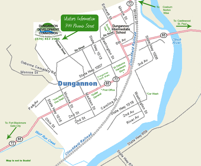
From Lexington, Kentucky: If you are coming from North West (Michigan, Indiana, etc.) you may want to consider using these directions into Dungannon instead of what you may have gotten from the Internet or a travel agency. The mountain roads that these directions take you on are very winding and steep. The following directions may be a little further to travel (it won't take much longer, though), but it is well worth the extra miles to arrive feeling well. (The scenery is also beautiful along this route.) From Lexington, KY-Take I75 South to Corbin, KY From Corbin, KY-Take 25 East to Middlesboro, KY From Middlesboro, KY-Take 58 East to Duffield, VA 58 will merge with 421 in Jonesville, VA to go on into Duffield. If you follow 58 alone, you will come into Big Stone Gap (You don't want to go this way). In Duffield, VA-Turn right when 58/421 merges with US 23. Follow US 23 5 miles to Clinchport, VA, where you will take a left turn onto State Route 65 North (Clinch River Hwy. You will follow 65 north approximately 14 miles to Ft. Blackmore, you will turn left on to State Route 72 (Veterans Memorial Hwy) proceed on Veterans Memorial Hwy for another 8-9 miles into Dungannon. When you see the "Cooperate Limits" sign on the right side of the highway your local map will be in effect. From Interstate 8:1 If you are traveling to Dungannon using Interstate 81, the easiest way to come into town is take Virginia Exit 14 (Abingdon). Turn Right off the interstate ramp, go to the 2nd stop light, turn right, go to the 2nd stop light and turn left. This will be State Route 19. Follow Route 19 approx 11 miles, turn left onto Alt Route 58. Follow Route 58 approx 11 miles, turn left at stop light on to State Route 65 (Mew Road). Follow approx 11 miles, where you will come to a stop sign in the town of Dungannon. |


